
Safeguarding-first GPS tracking
GPS Tracking for Ski Schools, DofE & School Trips
Know where everyone is. Keep everyone safe.
MeiliGPS makes safeguarding outdoors simpler. Follow your whole group live on secure iOS and Android apps for phone and tablet, and respond fast when it matters.
- 1:25,000 outdoor maps, worldwide, including Ordnance Survey in the UK, downloaded to your phone at no extra cost
- Navigate offline to any participant and retrace their route on the MeiliGPS app, even with no signal
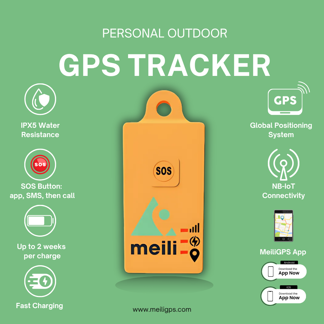
- Compact trackers, up to 14 days' battery, connecting where phones often can't
- Secure Sharing Centre: live locations shared only with viewers you invite
- Tested from the Alps to the Arctic Circle
- No contracts
- Pause between trips for £1 a month
Designed in Oxford · UK-hosted · Microsoft Azure ISO 27001 & Cyber Essentials Plus · No public tracking links


Built for the people who lead groups outdoors
Who it's for
Leading a DofE expedition, a Scout or Cadet trip, a school field day or a ski school group? Or heading off on a family adventure?
MeiliGPS gives you and your team a live view of every participant, individually or by group, so you can spot problems early and respond fast when something goes wrong.
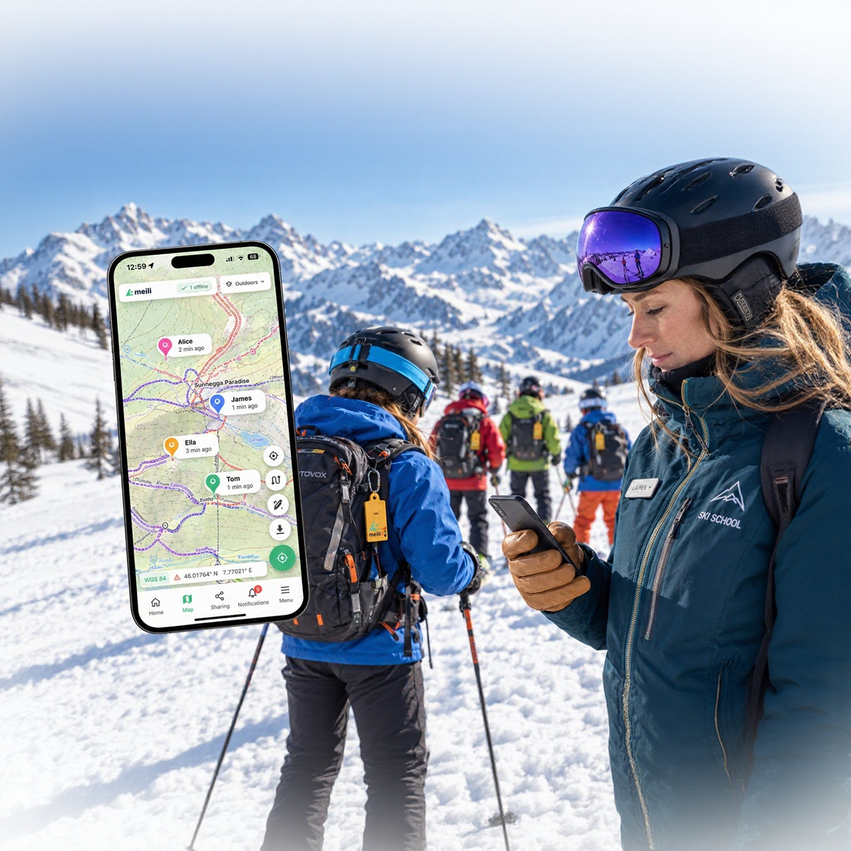
Group leaders: Mountain Leaders, ski instructors, DofE and school trip organisers see their whole group on one map, with alerts routed to the right people.
Families: Ski holidays, adventure trips or the walk to school, without giving a child a phone. A discreet SOS button alerts you if something’s wrong, and you decide who else can see where they are.
One system, three roles
How it works
Everything a group leader needs, from the trail to the office.
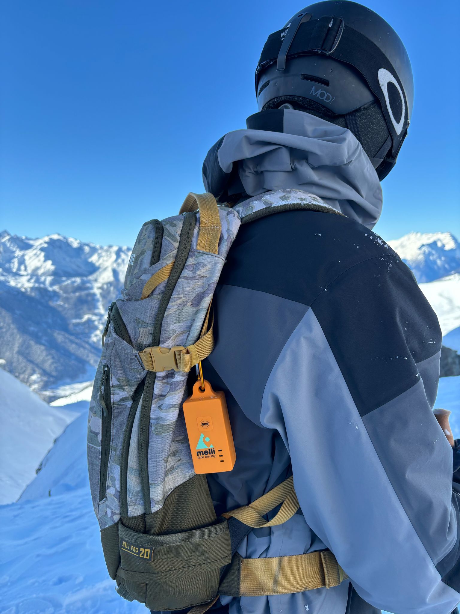
The tracker
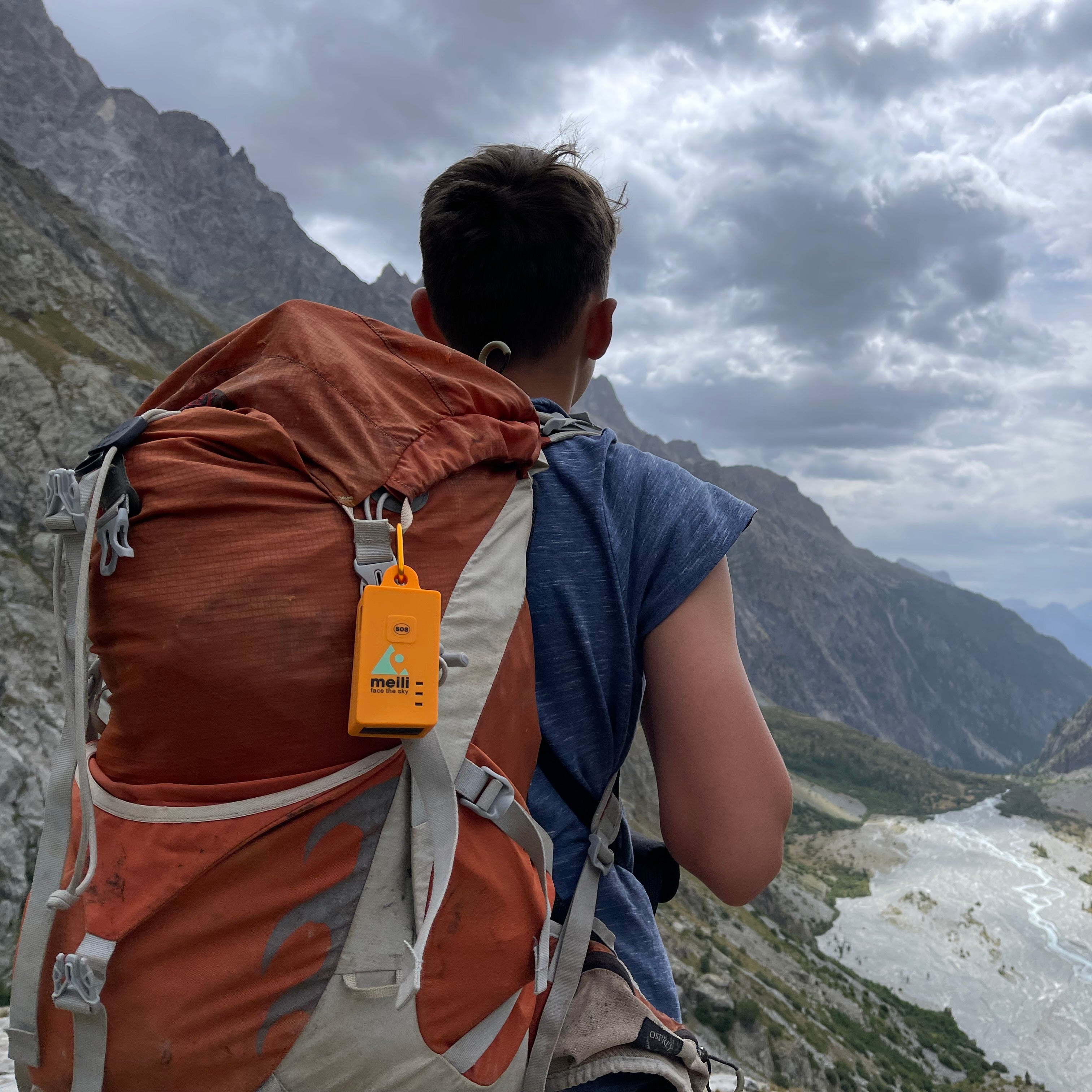
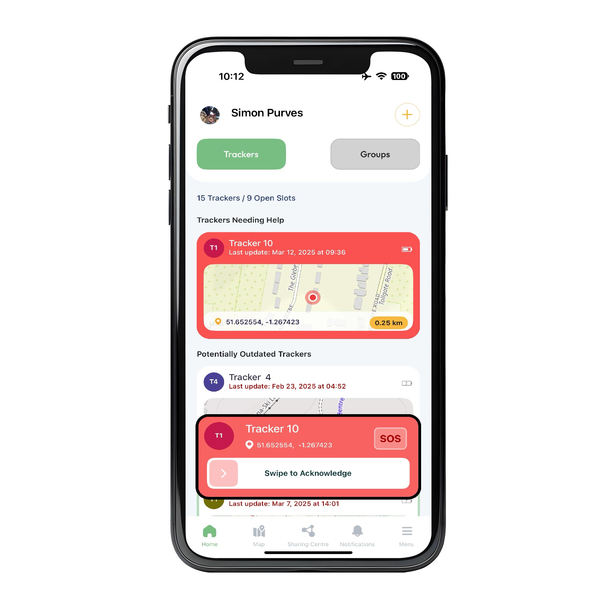
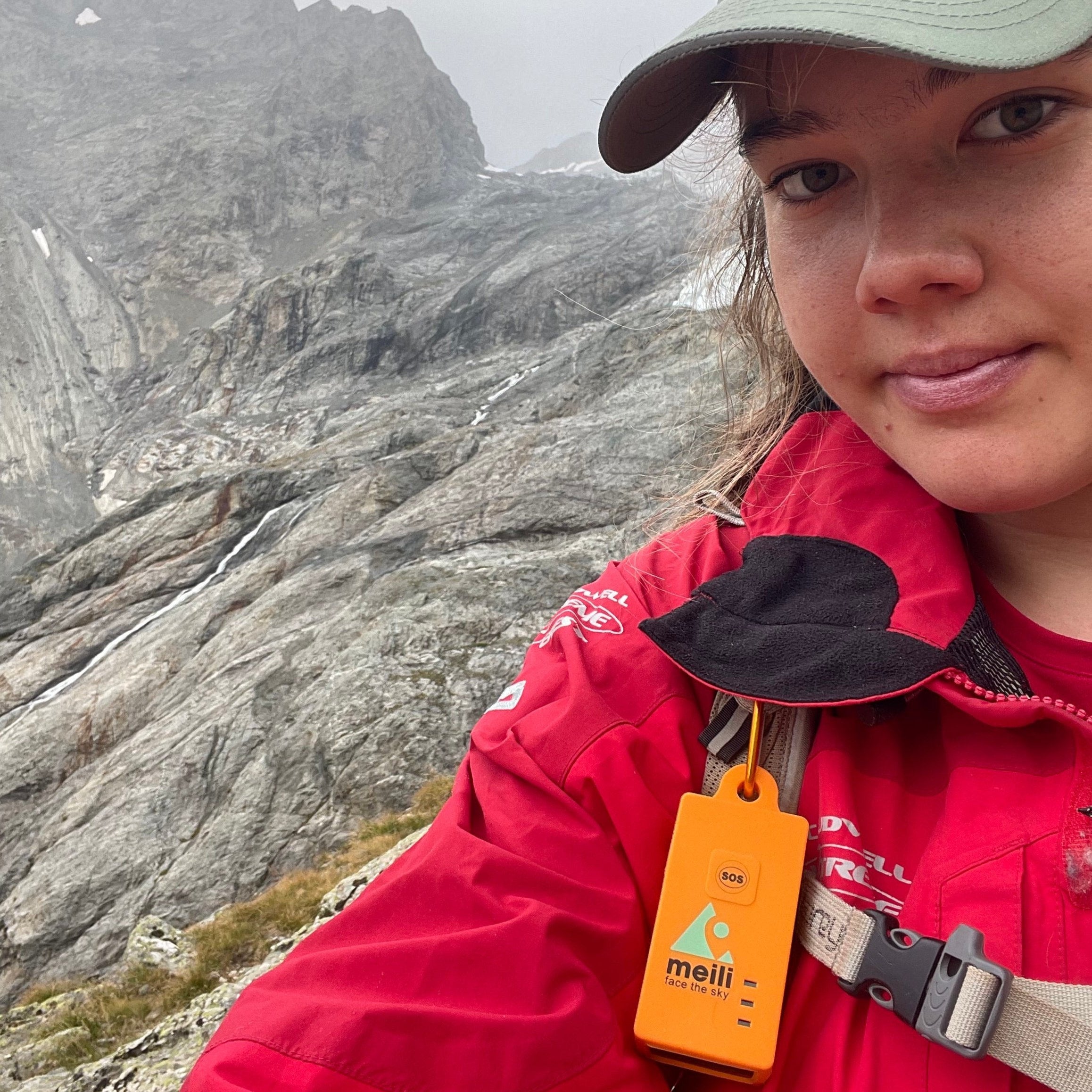
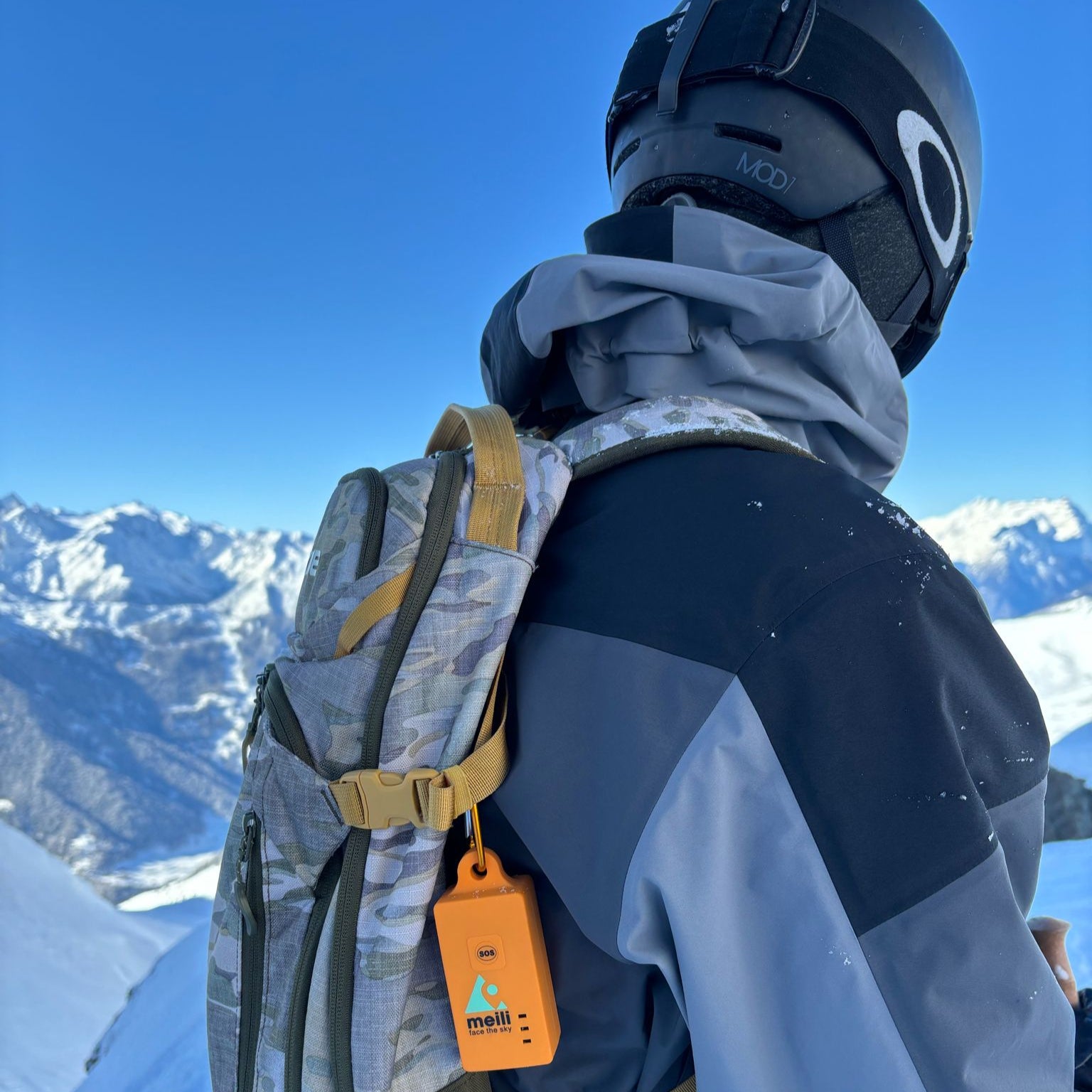
Each participant or group carries a small, screen-free tracker with an SOS button. It reports its position by itself over long-range low-power IoT networks, with no phone needed.
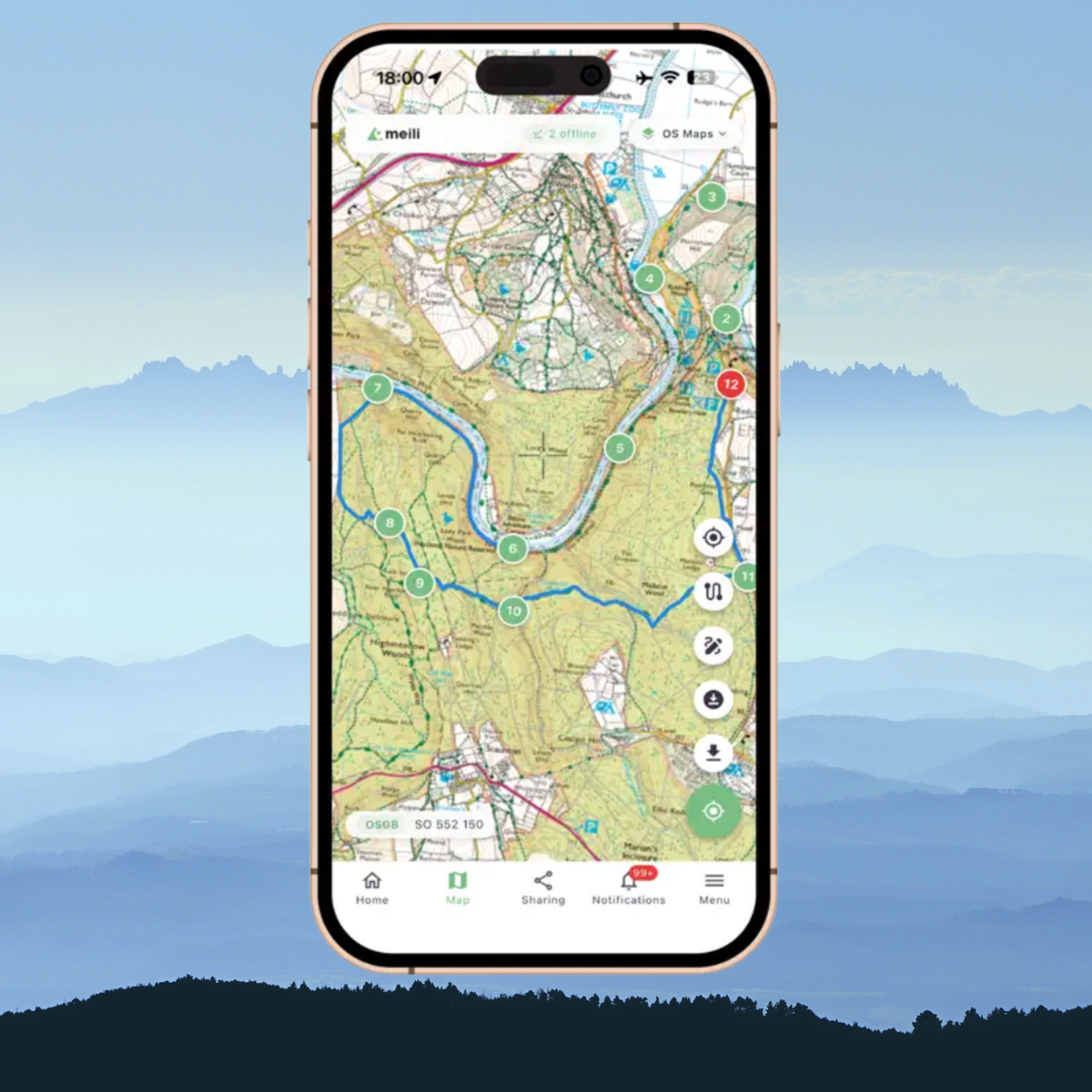
The app
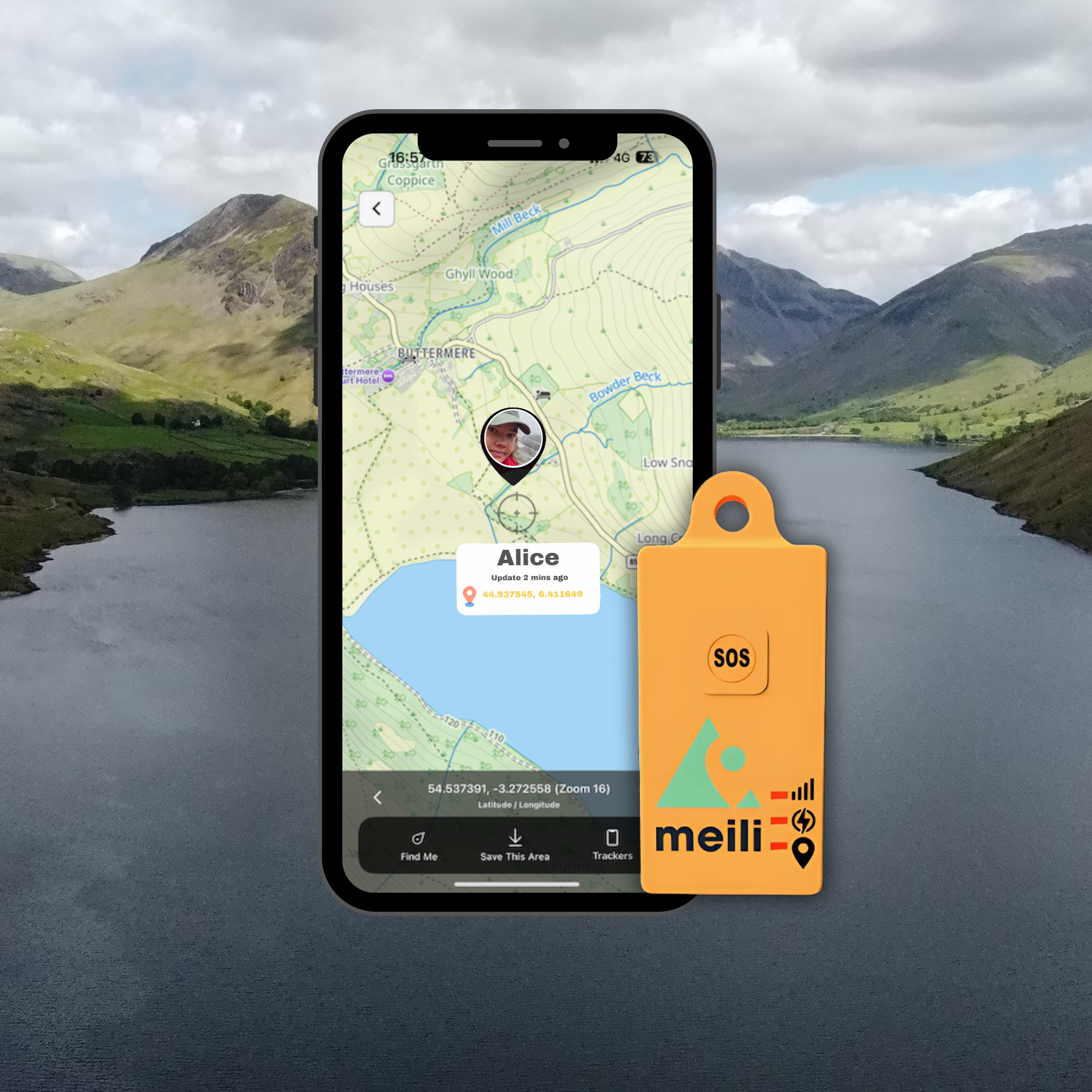
Leaders and invited viewers follow trackers live on iOS or Android, with OS 1:25,000 maps in the UK and detailed outdoor maps worldwide. SOS alerts arrive here first.
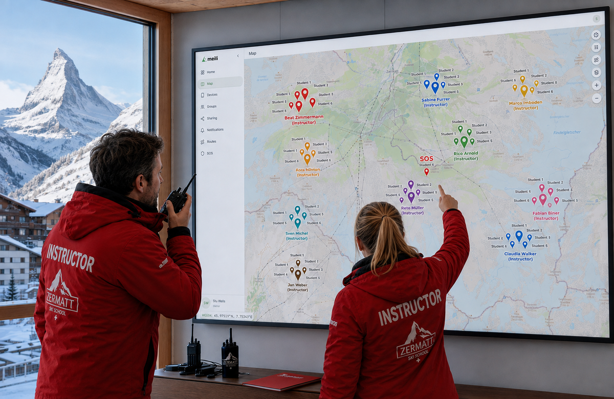
The web portal
Administrators set up trackers and groups, control who can see what, and open time-limited sharing sessions from a desktop browser.
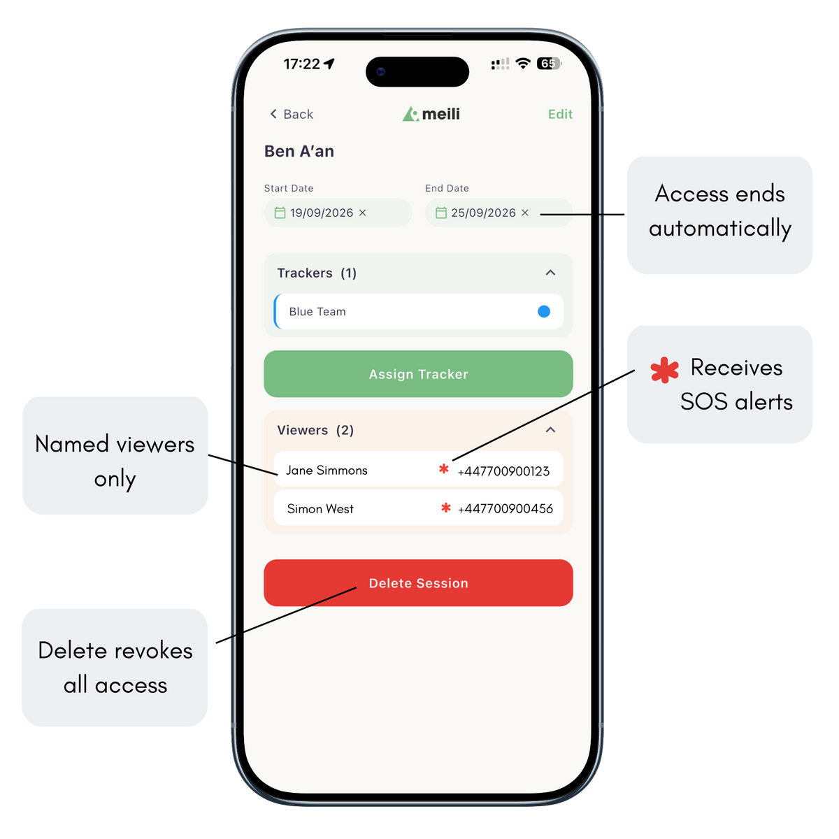
Safeguarding isn’t a feature. It’s how MeiliGPS is built.
SECURE BY DESIGN
MeiliGPS is built for organisations responsible for young people and lone workers. Location data is private by default, access is only ever granted to named people, and you decide how long it lasts.
Many tracking systems share location through open web links that can be forwarded to anyone. MeiliGPS doesn’t. Instead, administrators create a Sharing Session with set dates, add the trackers it covers, and invite named teachers, instructors, parents or volunteers by phone number. Viewers see only those trackers, only for that period, and you can revoke access at any time.
SOS alerts go to the people you’ve authorised, so the right person can respond, assess and escalate if needed.
Hosted in the UK on Microsoft Azure · Microsoft Azure ISO 27001 certified & Cyber Essentials Plus
Trusted in the field
IN THEIR WORDS
Safeguarding Lead, Europa School, England
Georgina Neville
Any tracker that allows locations to be shared via a shareable hyperlink should not, in our opinion, be used in a DofE, Scout or school setting.
One advantage of Meili is that the subs really are flexible, and we can pause them at any time without penalty.
News Crew, Nippon TV, Japan
Simon Bradley
When Ukraine became a regular destination, I was very glad to have found the Meili tracker.
It’s reliable, the battery life is excellent, and it does its thing in the background while I get on with travelling and filming.
Head of PE & DofE Manager, Aureus School, England
Rob Haydon
We are extremely satisfied with the accuracy, reliability, and ease of use of the MeiliGPS tracking system.
It has enhanced both safety and learning across our DofE programme, and we would confidently recommend Meili to every DofE group
Find the right setup for your group
SOLUTIONS

DofE, Scouts and school trips
Add MeiliGPS to your risk assessment and see every group on one map, from Bronze to Gold. Invited viewers get time-limited access, with no open links.

Ski schools and ski trips
Instructors see every student on the mountain, even when groups split up. SOS alerts go straight to the instructors nearby, with battery to last a full ski week.

Families and adventure holidays
Two trackers, one app, and peace of mind on the mountain or the walk home. Know where the kids are whilst giving them space to explore and adventure safely.


What it really costs over three years
Trackers, activation and airtime added up over three years, using each provider's published UK prices. Annual and monthly figures are the three-year total averaged out, so they include the cost of the trackers. Choose the scenario closest to yours.
A family with two trackers, used for a February half-term ski week, an Easter week, a two-week summer holiday and five weekend trips each year. That's five months of use, with trackers paused for the other seven.*
2 trackers at £95 (£190 to buy), with no activation fees. Airtime £7.99 a month for five months and £1 a month while paused.*
2 devices at £123.95. Flex plan about £18.31 a month including tracking, plus about £30.55 activation and a £35.65 annual Flex charge per device, payable even while suspended. £309 to buy, including activation.
2 devices at £149 plus £19.99 activation each (£338 to buy). Prepare plan at £17.99 a month plus the £4.50 Location Share+ add-on needed for live tracking, and £4 a month while paused, including its three-month minimum term in the first year.
2 inReach Mini 2 devices at about £230 plus £39.99 activation each (£540 to buy). Standard plan at £29.99 a month in use, the lowest personal plan with unlimited live tracking.
A school with eight trackers running ten DofE expeditions a year: four Bronze, four Silver and two Gold. Trackers are used in four months of the year and paused for the other eight.* Hire is costed for the same ten expeditions: eight weekends and two weeks.
8 trackers at £95. Airtime £7.99 a month for four months and £1 a month while paused for the other eight.* No activation or reactivation fees.
8 TrackTrail Max trackers at £150. £11.40 a month in use and £1.20 a month while dormant.
8 devices at £123.95. Flex plan about £18.31 a month including tracking, plus about £30.55 activation and a £35.65 annual Flex charge per device, payable even while suspended.
8 devices at £149, £19.99 activation each, the Prepare plan at £17.99 a month in use plus the £4.50 Location Share+ add-on needed for live tracking, and £4 a month while paused, including its three-month minimum term in the first year.
8 inReach Mini 2 devices at about £230, £39.99 activation each, and the Standard plan at £29.99 a month in use, the lowest personal plan with unlimited live tracking.
Each tracker hired for eight weekends (£19.80) and two weeks (£37.80) a year.
A ski school with 25 trackers, used throughout a six-month season, November to April, and paused for the other six months.*
25 trackers at £95. Airtime £7.99 a month for six months and £1 a month while paused for the other six.* No activation or reactivation fees.
25 devices at £123.95. Flex plan about £18.31 a month including tracking, plus about £30.55 activation and a £35.65 annual Flex charge per device, payable even while suspended.
25 devices at £149, £19.99 activation each, the Prepare plan at £17.99 a month in use plus the £4.50 Location Share+ add-on needed for live tracking, and £4 a month while paused.
25 devices at about £230 and about £47.99 activation each. Professional plans, which organisations use to manage many devices: the Pro Advanced plan with unlimited live tracking at about £41.99 a month, plus about £5.99 a month per device while suspended.
Built for the people responsible for others
Satellite messengers are built for individuals sharing their own position. MeiliGPS is built for Mountain Leaders, DofE organisers, ski instructors and anyone responsible for a whole group.
| Question | MeiliGPS | TrackTrail Max | Garmin inReach | ZOLEO | SPOT Gen4 |
|---|---|---|---|---|---|
| Who is it built for? | Group leaders. Every tracker and group on one map, with separate access for administrators, supervisors and invited viewers | Events and expeditions | Individuals, with Professional plans for teams | Individuals | Individuals |
| Who gets the SOS alert? | Your own team, first. An app alert, then an SMS, then a phone call, so it isn't missed on silent. You decide whether to escalate | SMS to up to three phone numbers | Garmin's international response centre | Global Rescue's response centre | An international response centre |
| What if a participant presses SOS by mistake? | No charges, ever. Your team sees the alert, checks in with the group and stands it down | Hire terms make the client responsible for any rescue costs, even if SOS was pressed accidentally | Handled by the response centre. Any emergency responder charges can fall to you | A misuse fee of up to $800 per false alarm, plus any responder charges | SPOT can bill a misuse fee, plus any responder charges |
| Can you reach an incident without signal? | Yes. OS 1:25,000 maps download to the app at no extra cost, and your phone's GPS guides you to the group's last reported position, with their breadcrumb trail, saved on your phone, showing the route they took | No. Browser-based, so maps need a data connection | No. The Explore app's offline maps are for your own device. Others follow you on MapShare or LiveTrack web pages, which need a connection. No OS maps | Partly. A leader added as a check-in contact can view each device's trail on downloaded maps, but the app isn't a navigation tool. No OS maps | No. The SPOT app needs a Wi-Fi or data connection to show locations |
| Who can see participants' locations? | Only people you invite and approve. Teachers, instructors, parents or volunteers are invited by name to a time-limited Sharing Session, and you can revoke access at any time. Expired sessions stay in your account as a record of who had access, and when. No public links, ever | Anyone with the web link. Password optional, one per link, so both can be forwarded, with no record of who viewed | Contacts, or anyone with a MapShare web link | Up to five chosen contacts, with a paid add-on | Contacts, or anyone with a SPOT web link |
| Is live tracking included? | Yes, unlimited, at no extra cost | Yes | Standard plan and above only | No. £4.50 a month add-on | Yes |
| What does it cost between trips? | £1 a month, paused from your account. No activation or reactivation fees | £1.20 a month dormant | Personal plans £0 for up to 12 months. Professional plans about £5.99 a month. £39.99 activation | £4 a month. £19.99 activation | Annual Flex charge, even when suspended. About £30.55 activation |
| How does it connect? | Long-range, low-power IoT networks that reach further and deeper than phone signal. The tracker needs only a trace of signal to send its position and status, so it often gets through when a phone shows no bars, including in buildings and under trees. Uses all four UK networks, and LTE-M networks in around 50 countries | Mobile networks, including LTE-M | By satellite, which needs a clear view of the sky. Tree cover, steep valleys and buildings can delay or block messages. Works beyond mobile networks | By satellite, which needs a clear view of the sky. Tree cover, steep valleys and buildings can delay or block messages. Works beyond mobile networks | By satellite, which needs a clear view of the sky. Tree cover, steep valleys and buildings can delay or block messages. Works beyond mobile networks |
Of the options compared here, only MeiliGPS combines all three things a group leader needs most: SOS alerts that come to your own team first, locations shared only with people you invite and approve, and downloaded OS maps to reach a group when there's no signal.
MeiliGPS is hosted in the UK on Microsoft Azure whose data centres hold Microsoft's ISO 27001 and Cyber Essentials Plus certifications, and protects accounts with two-factor authentication and encrypted location data.
* In each scenario, every option includes live tracking and is costed for the same active months, with the remaining months paused or suspended at each provider's own charge. MeiliGPS airtime is £7.99 a month while in use and £1 a month while paused, with no activation or reactivation fees. The DofE scenario is based on a real school's expedition programme.
Prices checked on 12 October 2026 from each provider's published UK prices, including VAT, and subject to change.
TrackTrail figures are for the TrackTrail Max, its tracker closest to MeiliGPS in size and battery life, bought or hired at TrackTrail's published LTE rates. TrackTrail publishes its prices excluding VAT, so we added 20% VAT.
Garmin is costed on its Standard personal plan, or its Pro Advanced professional plan for 25 trackers, the lowest tiers with unlimited live tracking; professional plan prices are published excluding VAT, so we added 20% VAT. ZOLEO is costed on its Prepare plan with the Location Share+ tracking add-on; the plan has a three-month minimum term on first activation. SPOT publishes UK prices in euros excluding VAT; we added 20% VAT and converted at €1 = £0.85. Garmin and ZOLEO device prices are typical UK retail prices. The family and ski school scenarios compare devices that families and ski schools typically buy.
Satellite devices such as Garmin inReach, ZOLEO and SPOT can work where there is no mobile network, but they need a clear view of the sky. Mobile coverage has grown fast: in the UK, 4G now reaches 95% of the landmass, including national parks such as the Lake District and Eryri, and MeiliGPS trackers can use all four UK networks. Abroad, they connect to LTE-M networks in around 50 countries, including most of Europe and the Alpine ski nations, Japan, Australia and New Zealand, North and South America, and parts of Africa and the Middle East. If your routes are mostly outside mobile coverage, talk to us before you buy.
Ready for your next trip?
Two trackers cost £190, with airtime at £7.99 a month each while you're away and £1 a month while paused.
Equipping a DofE programme?
Tell us how many groups you run and we'll suggest the right setup, then send a quote your bursar can approve.
Planning your season?
We'll help you size a fleet for your busiest week, and set up instructors and groups before you open.
No contracts. Pause any tracker for £1 a month between trips. No activation or reactivation fees.
Frequently Asked Questions
Meili GPS uses GPS satellites to determine its location and reports its position back via specialised radio signals using a built in SIM just like your phone but unlike your phone it uses NB-iot and LTE-M radio signals which give it much greater range. Unlike AirTag or other bluetooth devices Meili GPS works worldwide and independently without a connection to a phone as long as there is a local network available.
The Global Airtime Plan works in around 50 countries. The tracker needs NB-IoT or LTE-M coverage to send updates, which reaches further than ordinary phone signal but not everywhere. In deep valleys or very remote areas, updates may be delayed until the tracker regains coverage. If your route is mostly outside coverage, talk to us before you buy.
In the UK, Ordnance Survey 1:25,000 mapping. Worldwide, detailed Thunderforest outdoor maps. You can download map areas in advance for use with weak signal.
Up to two weeks on a charge with 10-minute updates and 12 hours of movement a day. The tracker saves power automatically when it is still. Colder weather and more frequent updates shorten battery life.
AirTags rely on being near other Apple devices to report their location. MeiliGPS trackers report independently over mobile networks, show your live route on outdoor maps, and include an SOS button.
Only people you authorise. Administrators can create time-limited Sharing Sessions that give named viewers access to selected trackers until the session ends or access is revoked. There are no public tracking links.
Each tracker needs an active Global Airtime Plan to send location updates and alerts. It covers all network costs, and you can pause, restart or cancel at any time.
Order your trackers and a matching number of airtime plans on this website. When they arrive, download the MeiliGPS app for iOS or Android and follow the on-screen steps to activate them.
Meili GPS Blog

Skiing with Kids and Groups: How GPS Trackers Like MeiliGPS Keep Everyone Safe and Connected
Skiing with kids or in a group should be about fun and freedom — not constant worry. GPS trackers like MeiliGPS help families and group leaders stay connected on the mountain, even in low-signal areas. With live tracking, offline ski maps, multi-parent monitoring, long cold-weather battery life, and an instant SOS feature for lost or distressed children, MeiliGPS delivers peace of mind without limiting adventure.
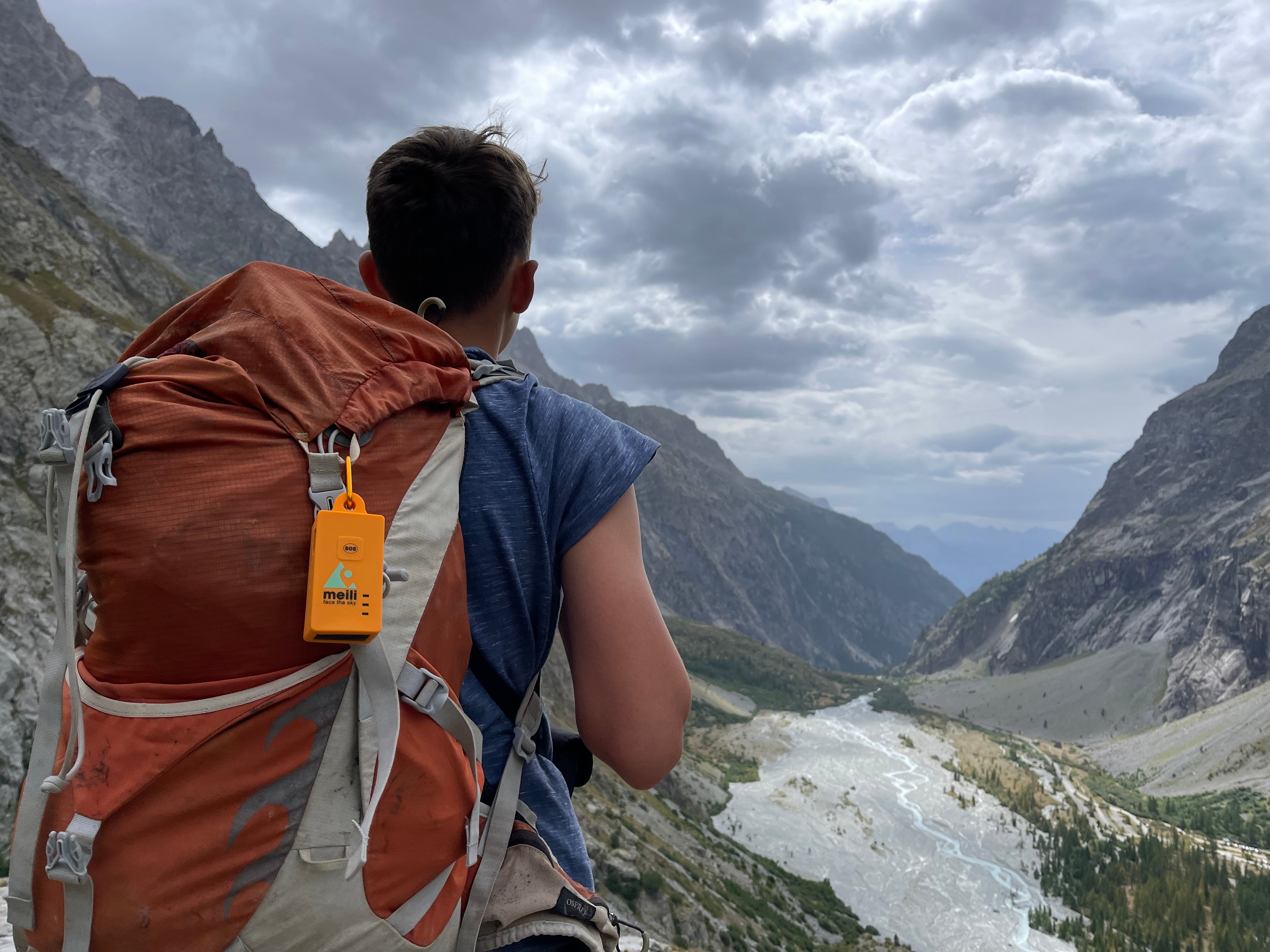
A GPS Tracker for a Person? GPS Trackers for Families? Meili GPS.
Whether you're an outdoor enthusiast seeking solo adventures or a parent aiming to enhance your child's safety without introducing them to smartphone-related pressures, Meili GPS trackers offer a reliable and secure solution. Stay connected, stay safe, and provide peace of mind for yourself and your loved ones with Meili GPS.

Risk Assessments and GPS Trackers for Expeditions
Is your DofE GPS tracking system exposing live location data via open links? Discover the safeguarding and compliance risks schools must assess — and the essential features of a secure expedition-ready system.