
Risk Assessments and GPS Trackers for Expeditions
Risk Assessments for Duke of Edinburgh Award Expeditions:
The Essential Role of GPS Trackers
Legal Responsibilities of Expedition Organisers
Organisers of Duke of Edinburgh (DofE) Award Expeditions, Scouts, Cadets, and school trips in the United Kingdom are bound by stringent health and safety laws. The Health and Safety at Work Act 1974 imposes a duty of care on those responsible for supervising expeditions, ensuring that risks are effectively managed. Failure to uphold this duty can result in severe legal penalties, including prosecution under corporate manslaughter laws. The Health & Safety Executive states that Expedition Organisers need to ensure that the precautions proposed are proportionate to the risks involved. The employment of GPS Trackers to unsupervised children in an outdoor environment is an example of a proportionate precaution to mitigate the inherent risks. Staff planning, and managing, expeditions and trips should be properly supported by their employers. Equipping staff with the organisations' GPS Trackers and Tracker Monitoring software is an example of the support that employers should provide.
A stark reminder of the consequences of negligence is the tragic case of the Scouts expedition to Great Orme in Llandudno. A failure to adequately assess risks and ensure safety precautions led to a verdict of Unlawful Killing for the organisers. This case underscores the critical importance of thorough risk assessments and the implementation of robust safety measures, including the use of appropriate GPS trackers.
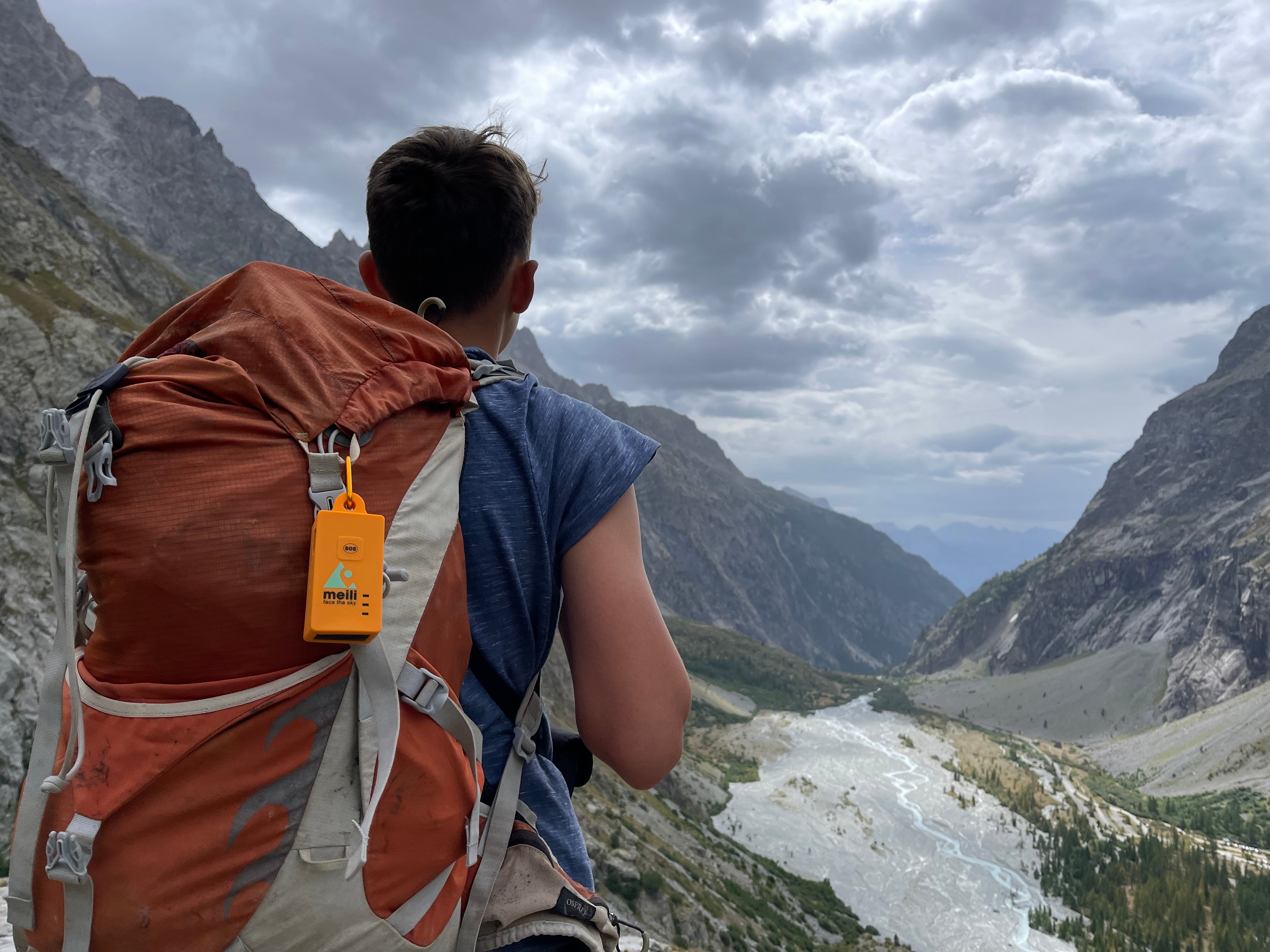
Choosing the Right GPS Tracker for Expeditions
To enhance safety and situational awareness, expedition organisers should select GPS trackers specifically designed for outdoor and expedition use. Not all GPS trackers are suitable; pet trackers, and AirTags, for example, are inadequate due to their reliance on proximity to personal devices (an AirTag must be within 100 metres of an Apple Device to function) and the potential privacy and safeguarding issues related to the use of GPS Trackers with under 18s and vulnerable persons (see point 4 below, Data Security & Access Control).
Essential Features of a Safeguarding-Ready GPS Tracking System for DofE Expeditions
When assessing GPS tracking systems for DofE and similar unaccompanied expeditions, schools must look beyond basic location visibility.
An expedition-ready system must address:
- Remote supervision reliability
- Safeguarding access control
- GDPR compliance
- Infrastructure resilience
- Emergency coordination
Below are the essential features schools and MATs should expect.
1. Secure Access Control — No Open URL Tracking Links
From a safeguarding perspective, the most critical control is who can access live tracking data.
Many tracking systems rely on shareable URLs or public web links to display expedition maps. While convenient, this creates significant safeguarding risk:
- Web Links can be forwarded
- Web Links can be screenshotted
- Web Links can remain active after expeditions end
- Web Links do not provide an audit trail of who has accessed the Link
- Access to Web Links cannot be controlled once they are distributed
- With shareable URLs/Web Links, there is no revocation control
For under-18 expeditions, this is unacceptable as GPS Live tracker data reveals:
- Real-time participant location
- Route history
- Overnight campsite positions
- SOS activation status
A safeguarding-ready GPS system must instead provide:
- Named user accounts
- Role-based permissions
- Explicit invitation and approval
- Two-factor authentication
- Manual and automatic access revocation
- Full audit logs
Location data for minors must never be accessible via open hyperlinks.
Secure access control is not a feature. It is a safeguarding requirement.
2. Offline-Capable iOS and Android Apps
Expedition environments frequently include:
- Valleys
- Dense woodland
- Mountain terrain
- Rural signal blackspots
A browser-based web tracker becomes unusable when mobile connectivity drops.
Schools should require dedicated iOS and Android mobile applications that retain the following functionality when no cellular/mobile signal is available:
- Continue functioning offline using the mobile device's GPS connectivity
- Store downloaded map tiles to allow offline map access
- Retain and display the last known tracker positions when offline
- Allow navigation to stored coordinates using offline maps
Supervision must not depend on a continuous mobile signal.
To mitigate further risk:
- All adult expedition assistants should have app access
- Monitoring teams should carry two-way VHF radios
- Incident locations should be stored offline on mobile devices to mitigate against loss of signal during searches.
Case Example
During an Oxfordshire school’s Bronze DofE expedition, teachers received an SOS alert from a tracker assigned to a group. A supervising teacher cycling to the alert location lost mobile signal in dense woodland.
Because she was using an offline-capable GPS tracking app with pre-downloaded 1:25,000 maps and stored incident coordinates, she was able to navigate to the distressed group despite having no mobile connectivity.
Communication with the wider team was maintained via two-way radio.
Offline capability directly prevented escalation of the incident.
3. High-Resolution 1:25,000 Scale Outdoor Mapping
Expedition supervision requires detailed mapping beyond consumer navigation apps.
Generic platforms such as Google or Apple Maps do not provide:
- Topographical contour data
- Footpath detail
- Terrain features
- Remote infrastructure visibility (e.g. ski resorts/mountain bike trails etc)
GPS tracking systems used for DofE should provide:
- 1:25,000 scale mapping
- Topographical detail
- Outdoor route clarity
- Overseas mapping capability
Case Example
A school that initially deployed trackers for DofE expeditions later expanded use after an incident on a ski trip where students became lost.
Global Offline 1:25,000 mapping enabled teachers to monitor students across an Italian ski resort, with visibility of:
- Chair lifts
- Pistes
- Run difficulty
- Terrain hazards
Generic mapping would not have provided sufficient operational clarity.
4. Precise Location Reporting — Lat/Long & OS Grid References
In emergency situations, first responders may require:
- Latitude / Longitude coordinates
- OS Grid references (UK)
An expedition-ready tracker must support both.
This ensures compatibility with:
- Mountain rescue
- Emergency services
- Local navigation systems
Precision reporting reduces response time and miscommunication risk.
5. Data Security, Infrastructure & Third-Party Access Controls
Safeguarding does not end at the user interface.
Schools must also assess infrastructure-level security.
Location data of minors should:
- Be encrypted in transit and at rest
- Be hosted in the UK
- Not be stored in overseas jurisdictions without safeguards
- Not be accessible to unauthorised third parties at database level
The tracking provider should demonstrate:
- ISO27001 alignment
- Cyber Essentials certification
- Clear Data Processing Agreements
- No uncontrolled third-party database access
Expedition tracking data should never be accessible via open APIs or unsecured backend systems.
Secure infrastructure is as important as secure front-end access.
6. Controlled Sharing & Revocation
Expedition environments require temporary access for:
- Assessors
- Volunteers
- Assistant organisers
- Safeguarding leads
However, that access must be:
- Time-limited
- Role-specific
- Revocable immediately
- Automatically expired at expedition end
Persistent URL access that remains active indefinitely creates unnecessary safeguarding exposure.
Controlled sharing centres with explicit permission management are essential.
7. Battery Life Suitable for Multi-Day Expeditions
Battery reliability is operationally critical.
GPS functionality drains power rapidly, especially:
- In cold conditions
- During continuous tracking
- On consumer smart devices
Expedition trackers should:
- Operate for 5–7 days minimum
- Use internal rechargeable lithium-ion batteries
- Avoid reliance on disposable AA batteries
- Avoid consumer smartwatches or phones as primary trackers
Battery failure during an unaccompanied expedition is a foreseeable risk that should be addressed in risk assessment documentation.
Final Principle
An expedition-ready GPS tracking system is not simply one that shows dots on a map.
It must:
- Prevent unauthorised access
- Function offline
- Provide precise outdoor mapping
- Protect sensitive data
- Support organiser & emergency coordination
- Withstand multi-day conditions
Most importantly, it must recognise that location data of minors is safeguarding-sensitive information.
Open URL tracking links are incompatible with that responsibility.
Comments