
DofE expedition tracking made simple
GPS Tracking for Duke of Edinburgh Award Expeditions
Know where every group is. Keep students' locations private.
MeiliGPS gives DofE leaders a live view of every expedition group on one map, with SOS alerts to your own team and locations shared only with the people you choose.
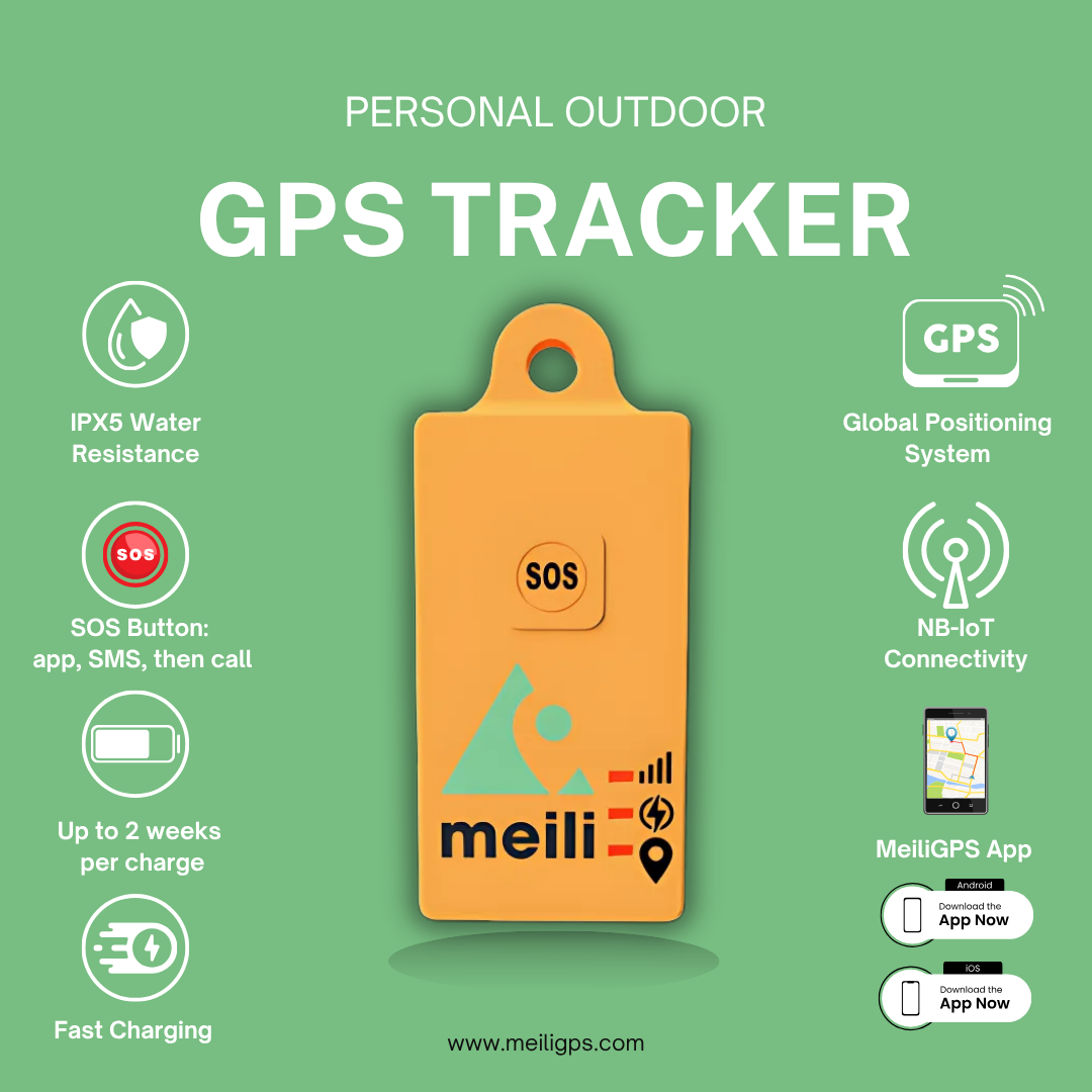
- Ordnance Survey 1:25,000 maps, included and offline, so you can reach a group even with no signal
- Safeguarding-first sharing: staff, volunteers and assessors invited by name, for the expedition dates only. No public links
- SOS to your own team, by app, then SMS, then a phone call, with no charges for accidental alerts
- Own your trackers and pause airtime between expeditions for £1 a month
- No public links
- No phones needed
- Pause between expeditions
Designed in Oxford · UK-hosted on Microsoft Azure · Microsoft Azure ISO 27001 & Cyber Essentials Plus

How MeiliGPS works on a DofE expedition
Set up once, then reuse for every Bronze, Silver and Gold expedition. Students carry a tracker; leaders do everything else from their phones.
- Before you goAssign a tracker to each group, upload their route as a GPX file and download the OS maps for the area. Invite staff, volunteers and assessors by name to a Sharing Session for the expedition dates.
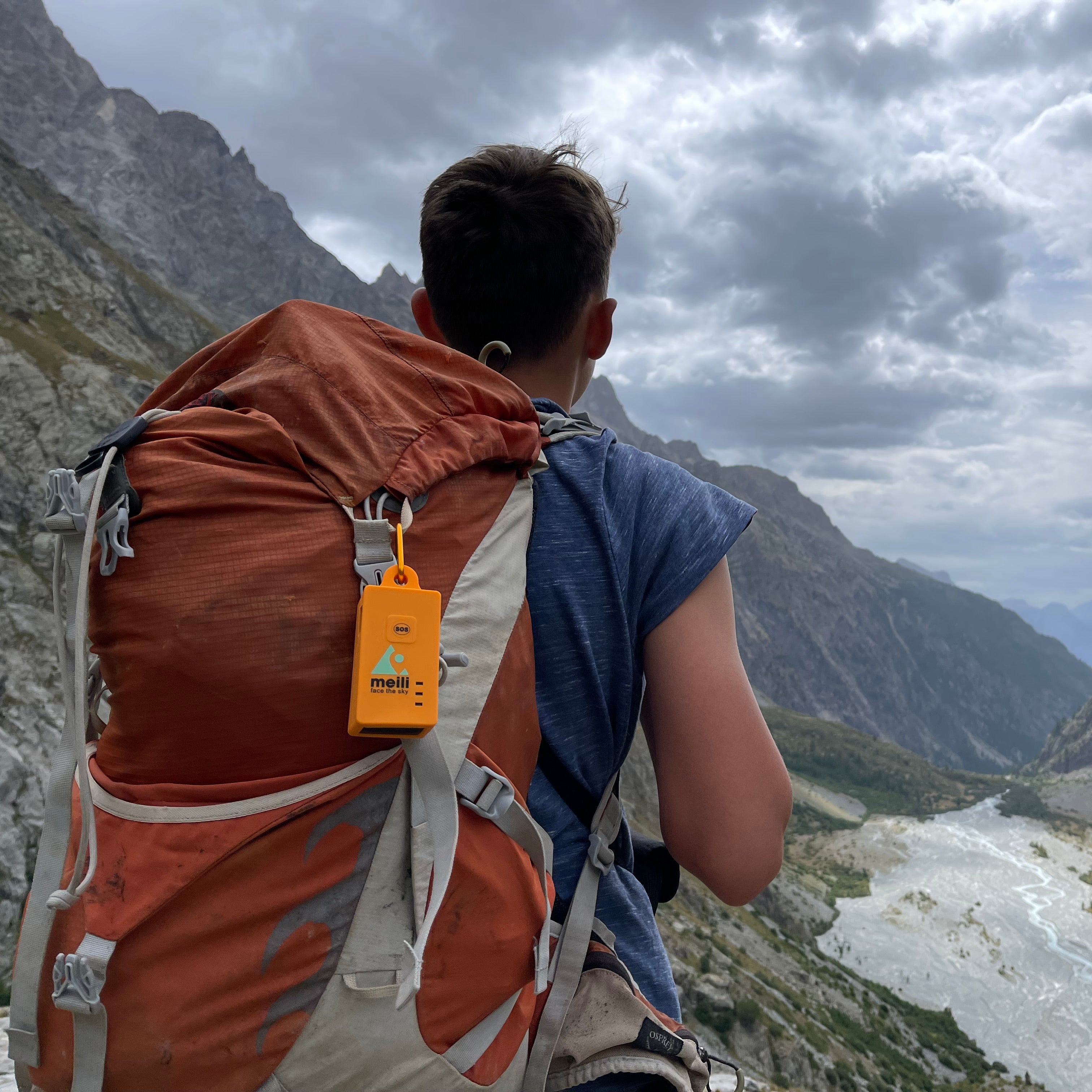
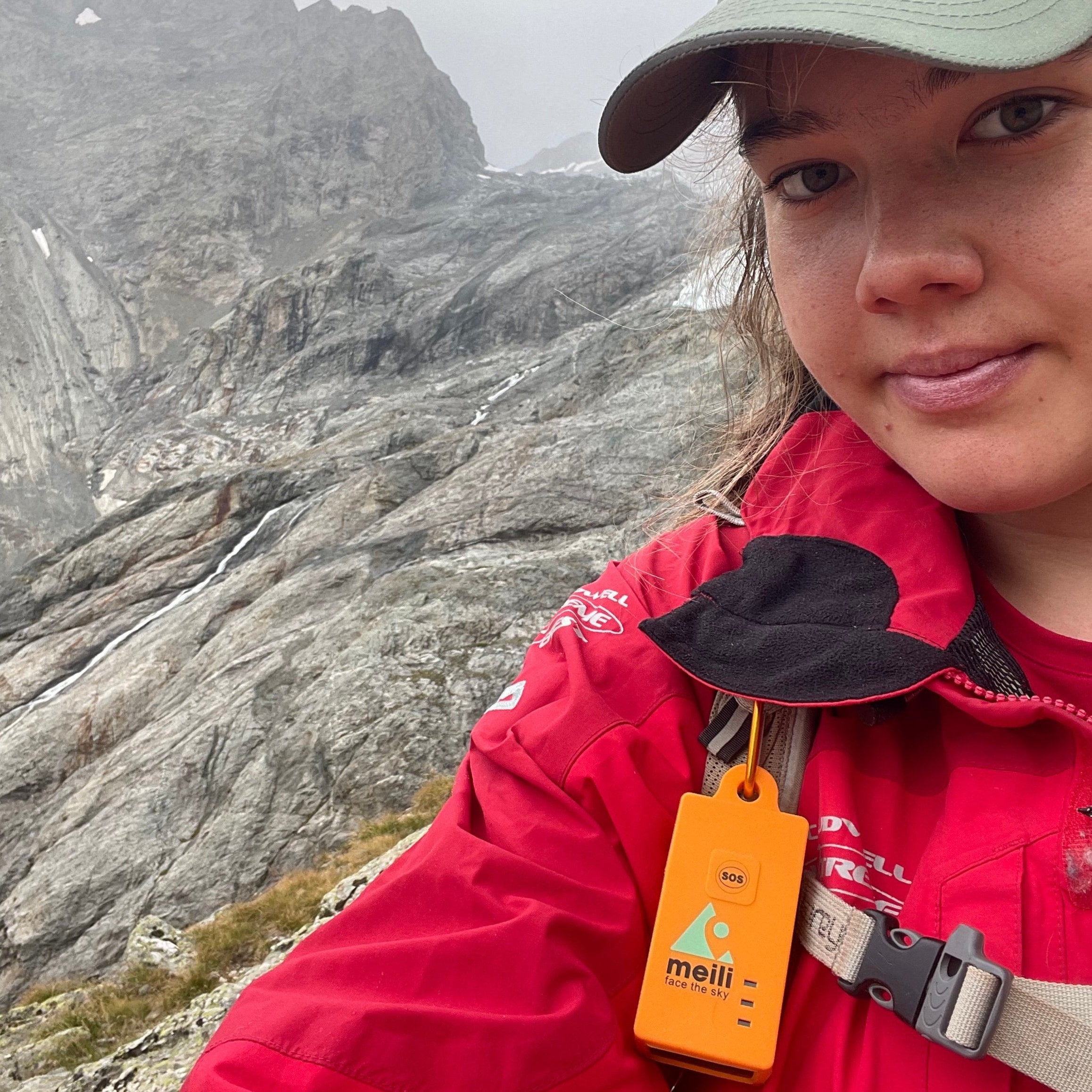
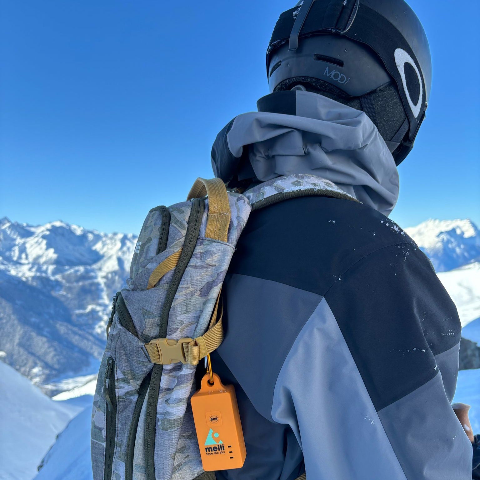
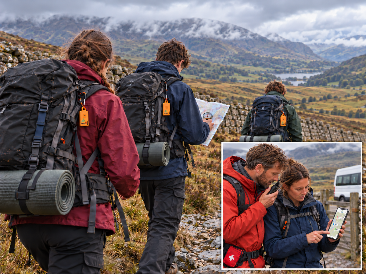
- Set offEach group clips a tracker to a rucksack. There's no screen and nothing to operate, so students navigate with map and compass, and nobody needs a phone.
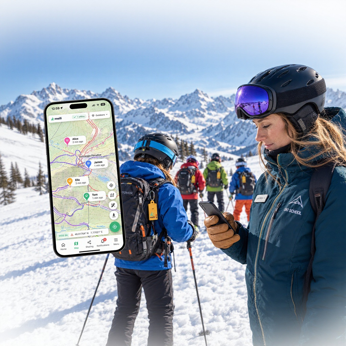
- On expeditionLeaders follow every group on one map, spot a group that's off route or behind schedule, and send volunteers where they're needed. An SOS goes to the whole team, by app, then SMS, then a phone call.
- AfterwardsThe Sharing Session ends automatically, and stays in your account as a record of who had access. Pause each tracker for £1 a month until the next expedition.
Fewer volunteers sitting at checkpoints all day. Because leaders can see when each group is approaching a checkpoint, they can move volunteers to where they're needed, and run expeditions with more students and fewer helpers.

Safeguarding built in
The Sharing Centre: only the people you choose, only for the expedition
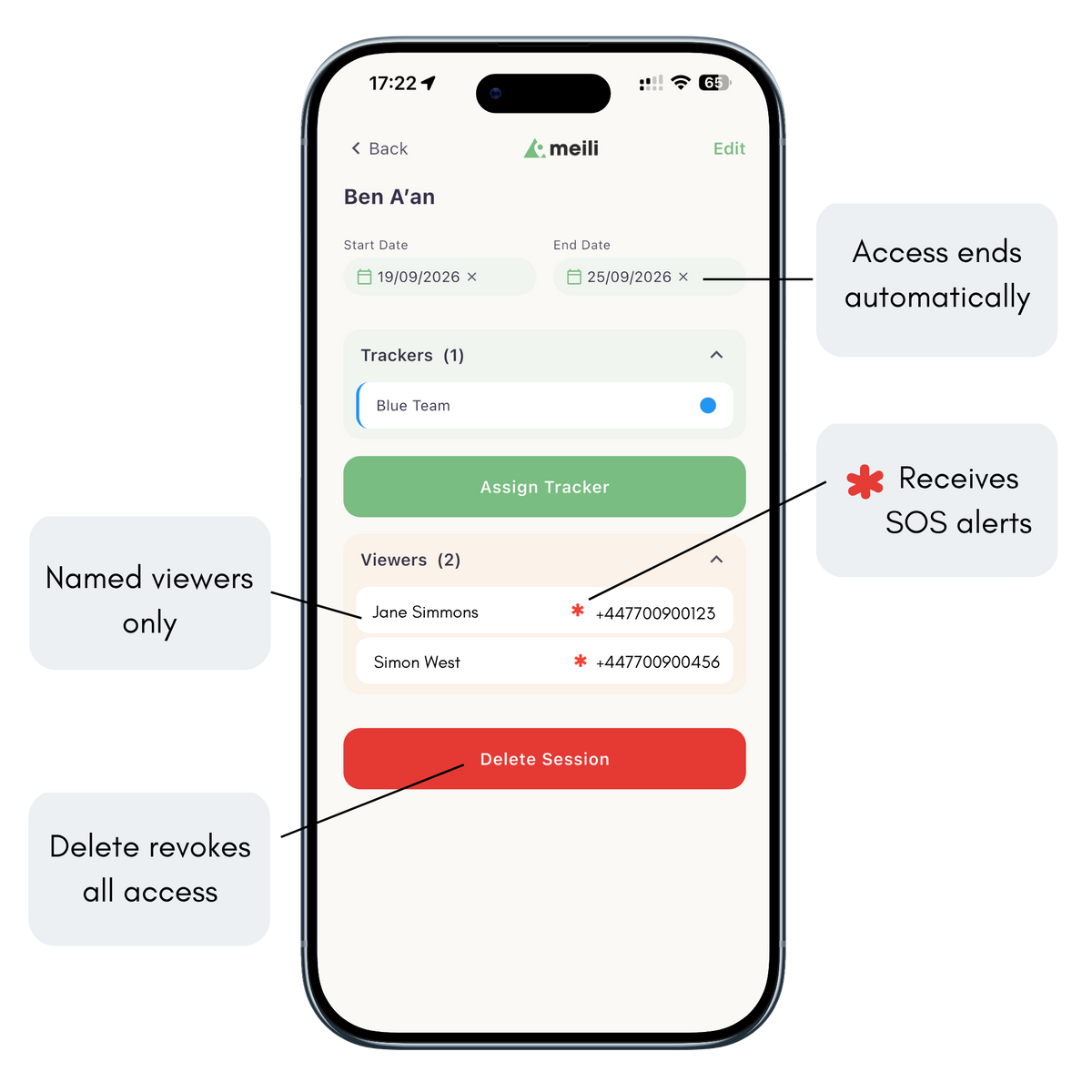
Students' live locations are among the most sensitive data a school holds. In MeiliGPS, nobody sees them unless you invite them, by name, inside the secure app or web portal.
- Invite by name: staff, volunteers and assessors, each verified by phone
- Choose what they see: one group, several, or the whole expedition
- Set the dates: access starts and ends with the expedition, automatically
- With or without SOS alerts: assessors can follow groups without SOS responsibility
- Revoke at any time, and keep a record of who had access, and when
A web link can be forwarded. A Sharing Session can't. There's no link to copy into a WhatsApp group, so students' locations never leave the people you approved.

Included at no extra cost
Ordnance Survey maps, offline, in every MeiliGPS app
DofE expeditions are planned and walked on Ordnance Survey maps. MeiliGPS shows every group on the same OS 1:25,000 mapping, in the app and the web portal, with no map licence to pay for.
- Download before you go: save the expedition area to your phone
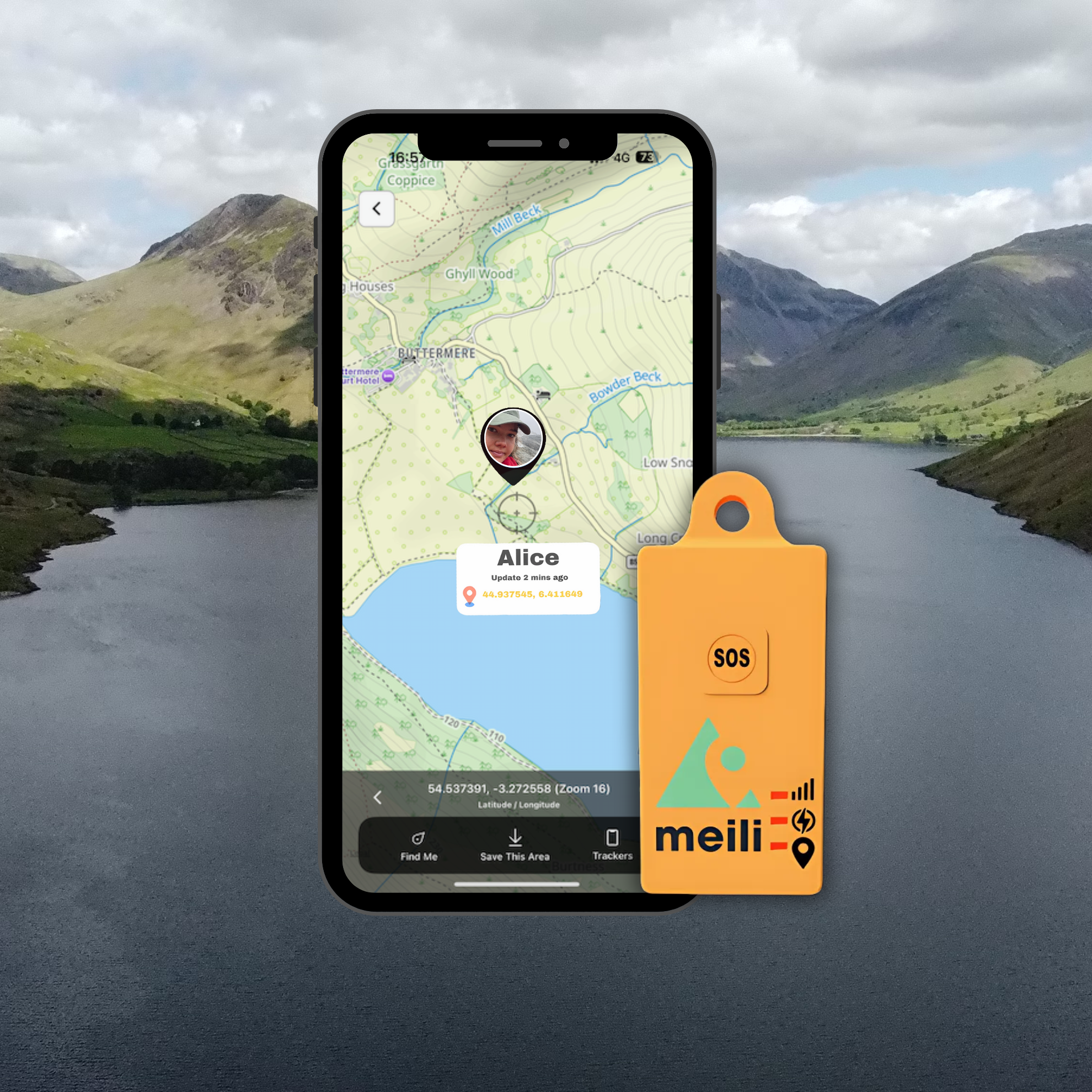
- See groups against their route: planned GPX route and actual track, on OS mapping
- Every group's last position and trail are saved on your phone
- Navigate with no signal: your phone's GPS guides you to a group on the downloaded map
Others charge extra for OS maps, or don't offer them. TrackTrail charges for OS mapping and needs a data connection to show it. Garmin, ZOLEO and SPOT don't offer OS maps at all.
Benefits of GPS Tracking for DofE Expeditions
- Risk assessment: Give each team a tracker, with no mobile phones needed, and see where every group is throughout the expedition. Spot a group that’s off-route or behind schedule before it becomes an incident.
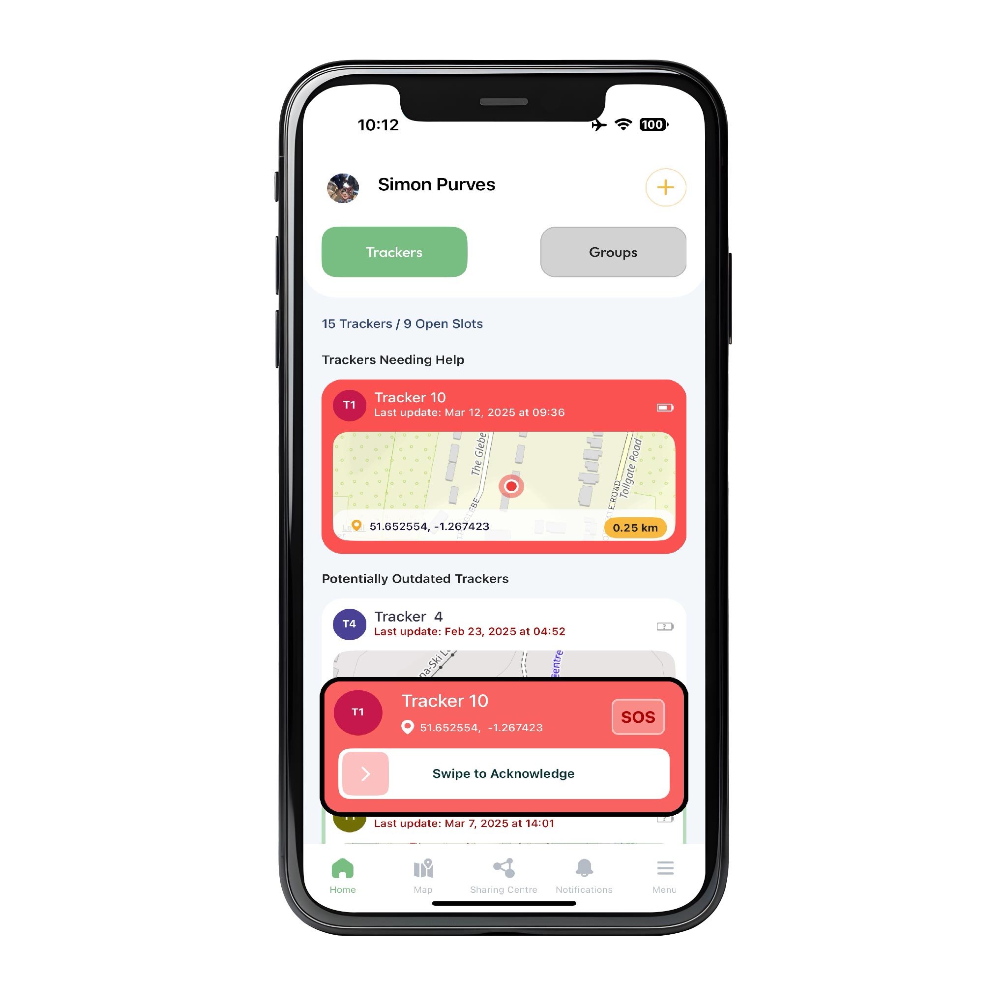
- Fast SOS response: One press of the SOS button alerts your supervisors by app, then SMS, then phone call, with the group’s exact position, so your team can assess, respond and escalate if needed.
- Safeguarding-first access: Students’ locations are never shared through open web links. Supervisors, assessors and volunteers are invited by name to a time-limited Sharing Session, and you can revoke access at any time.
- Route management: Upload each team’s route as a GPX file, then see the path they’ve actually walked on OS 1:25,000 mapping. Spot wrong turns early and send volunteers where they’re needed.
- Offline maps: Unlike web-based tracking services, the MeiliGPS app stores OS maps on your phone. If you lose signal, you can still see each group’s last reported position and navigate to it.
- Nothing for students to operate: No screen, no messaging and no navigation, so the tracker preserves real map-and-compass skills, and students need no phone.

What a DofE programme really costs over three years
A school with eight trackers running ten DofE expeditions a year: four Bronze, four Silver and two Gold, across eight weekends and two weeks. Trackers are used in four months of the year and paused for the other eight.* Every option includes live tracking. Annual and monthly figures are the three-year total averaged out, so they include the cost of the trackers.
8 trackers at £95, owned outright. Global Airtime Plan £7.99 a month for four months and £1 a month while paused.* No activation or reactivation fees. OS maps included.
8 TrackTrail Max trackers at £150. £11.40 a month in use, including the OS maps licence, and £1.20 a month while dormant.
8 devices at £123.95. Flex plan about £18.31 a month including tracking, plus about £30.55 activation and a £35.65 annual Flex charge per device, payable even while suspended.
8 devices at £149, £19.99 activation each, the Prepare plan at £17.99 a month in use plus the £4.50 Location Share+ add-on needed for live tracking, and £4 a month while paused, including its three-month minimum term in the first year.
8 inReach Mini 2 devices at about £230, £39.99 activation each, and the Standard plan at £29.99 a month in use, the lowest personal plan with unlimited live tracking.
Each tracker hired per expedition: eight hires of up to 3 days (£19.80) and two one-week hires (£37.80) a year, including the OS maps option. Delivery not included.
Each tracker hired per expedition: eight hires of up to 3 days (£30) and two one-week hires (£42) a year. Delivery not included.
Each tracker hired per expedition: eight 3-day hires (£42) and two one-week hires (£48) a year. Delivery not included.
MeiliGPS costs less than a third of hiring TrackTrail trackers, and less than half the cost of buying any of the satellite messengers. Over three years, it saves this school £806 compared with buying TrackTrail trackers, and up to £8,649 compared with hiring satellite trackers.
Built for the people responsible for DofE groups
Satellite messengers are built for individuals sharing their own position. Web-based trackers share a link. MeiliGPS is built for DofE leaders responsible for every group on the expedition.
OEAP National Guidance names the risk directly: "safeguarding concerns, e.g., if an unauthorised person is able to track a child." OEAP National Guidance, 4.2a Group Management and Supervision
| Question | MeiliGPS | TrackTrail | Garmin inReach | ZOLEO | SPOT Gen4 |
|---|---|---|---|---|---|
| Who is it built for? | DofE leaders. Every tracker and group on one map, with separate access for administrators, supervisors and invited viewers | Events and expeditions | Individuals, with Professional plans for teams | Individuals | Individuals |
| Who can see where students are? | Only people you invite and approve. Staff, volunteers and assessors are invited by name to a time-limited Sharing Session, with or without SOS alerts. You can revoke access at any time, and expired sessions stay in your account as a record of who had access, and when. No public links, ever | Anyone with the web link, protected at most by one shared password, so the link and password can be forwarded, for example to a WhatsApp group. No individual viewer accounts, so no record of who viewed | Contacts, or anyone with a MapShare web link | Up to five chosen contacts, with a paid add-on | Contacts, or anyone with a SPOT web link |
| How do leaders follow groups? | Secure iOS and Android apps, with named accounts and two-factor authentication, plus a secure web portal for tablets and larger screens, using the same login and the same access rules | A web page, opened in any browser with the link. No app or viewer accounts | Each device pairs with its owner's Garmin app. Others follow on MapShare web pages | Each device pairs with its owner's ZOLEO app. Check-in contacts can follow in the app | The SPOT app for the account holder. Others follow on SPOT web pages |
| Can you reach an incident without signal? | Yes. OS 1:25,000 maps download to the app at no extra cost. Each group's last position and breadcrumb trail are saved on your phone, and your phone's GPS guides you to them with no signal | No. The map is browser-based, so it needs a data connection. Navigation hands over to Google Maps | No. The Explore app's offline maps are for your own device. Others follow on web pages, which need a connection. No OS maps | Partly. A leader added as a check-in contact can view each device's trail on downloaded maps, but the app isn't a navigation tool. No OS maps | No. The SPOT app needs a Wi-Fi or data connection to show locations |
| Who gets the SOS alert? | Your whole team, first. An instant app alert to every supervisor, then an SMS, then a phone call until someone responds. A ten-second hold prevents accidental alerts, and the tracker buzzes to tell students help is coming | An SMS to up to three phone numbers | Garmin's international response centre | Global Rescue's response centre | An international response centre |
| What if a student presses SOS by mistake? | No charges, ever. Your team sees the alert, checks in with the group and stands it down | Hire terms make the client responsible for any rescue costs, even if SOS was pressed accidentally | Handled by the response centre. Any emergency responder charges can fall to you | A misuse fee of up to $800 per false alarm, plus any responder charges | SPOT can bill a misuse fee, plus any responder charges |
| What does airtime cost? | £7.99 a month, on the Global Airtime Plan, with unlimited live tracking and OS maps included | £11.40 a month in use, including the OS maps licence | £29.99 a month for unlimited live tracking (Standard plan) | £22.49 a month with the live tracking add-on | About £18.31 a month, plus an annual Flex charge |
| What does it cost between expeditions? | £1 a month per tracker, paused and restarted from your account whenever you choose. No activation or reactivation fees | £1.20 a month dormant, or hire for each expedition | Personal plans £0 for up to 12 months. £39.99 activation | £4 a month. £19.99 activation | Annual Flex charge, even when suspended. About £30.55 activation |
| How does it connect? | Long-range, low-power IoT networks that reach further and deeper than phone signal, including under trees and in buildings. Uses all four UK networks | Mobile networks, including LTE-M | By satellite, which needs a clear view of the sky. Tree cover, steep valleys and buildings can delay or block messages | By satellite, which needs a clear view of the sky. Tree cover, steep valleys and buildings can delay or block messages | By satellite, which needs a clear view of the sky. Tree cover, steep valleys and buildings can delay or block messages |
Of the options compared here, only MeiliGPS combines all three things a DofE leader needs most: SOS alerts that come to your own team first, students' locations shared only with people you invite and approve, and downloaded OS maps to reach a group when there's no signal.
MeiliGPS is hosted in the UK on Microsoft Azure, whose data centres hold Microsoft's ISO 27001 and Cyber Essentials Plus certifications, and protects every staff account with two-factor authentication and encrypted location data.
Equipping a DofE programme?
Build your quote in two minutes: see the price straight away, then get a personalised quote your bursar can approve.
No contracts. Pause any tracker for £1 a month between expeditions. No activation or reactivation fees.
* Every option includes live tracking and is costed for the same four active months a year, with the remaining months paused, dormant or suspended at each provider's own charge. Hire is costed per tracker for each of the same ten expeditions. The scenario is based on a real school's expedition programme.
Prices checked on 14 October 2026 from each provider's published UK prices, including VAT, and subject to change. TrackTrail figures are for the TrackTrail Max, its tracker closest to MeiliGPS in size and battery life, and for SPOT and ZOLEO trackers hired from TrackTrail, at TrackTrail's published rates for 1 to 9 trackers. TrackTrail Max figures include TrackTrail's OS maps option, since MeiliGPS includes OS maps as standard. Hire excludes TrackTrail's delivery charge. TrackTrail publishes its prices excluding VAT, so we added 20% VAT.
Bought satellite messengers are costed on plans with unlimited live tracking: Garmin's Standard plan and ZOLEO's Prepare plan with the Location Share+ add-on, which has a three-month minimum term on first activation. SPOT publishes UK prices in euros excluding VAT; we added 20% VAT and converted at €1 = £0.85. Garmin and ZOLEO device prices are typical UK retail prices.
Satellite devices can work where there is no mobile network, but they need a clear view of the sky. In the UK, 4G now reaches 95% of the landmass, including national parks such as the Lake District and Eryri, and MeiliGPS trackers can use all four UK networks. If your expedition routes are mostly outside mobile coverage, talk to us before you buy.


Trusted by DofE organisers
Why Europa School chose MeiliGPS
"Any tracker that allows locations to be shared via a shareable hyperlink should not, in our opinion, be used in a DofE, Scout or school setting." Georgina Neville, DofE organiser, Europa School, Oxfordshire
Georgina's three lessons for choosing a tracker
- Match your safeguarding policyAvoid trackers that share locations by link, and make sure you have an audit trail showing who was given access, and that it ended with the expedition.
- Watch for hidden subscription costsLook out for plans paid annually in advance, and "flexible" plans with reactivation fees. MeiliGPS can be paused at any time without penalty.
- Choose good group managementSeeing where every group is means volunteers no longer wait at checkpoints all day, so you can run expeditions with more students and fewer helpers.
Read the full interview below, including how her school saves on tracker hire and responds to incidents without signal.
Interview: Why a DofE Organiser chose MeiliGPS
Oh wow, ages! I've been organising DofE expeditions at the Europa School for over 10 years. Before that I worked in Outdoor Education and was a Mountain Leader: doing everything from leading a team of doctors up Mount Everest to taking groups to the Atlas Mountains of North Africa.
I run the annual DofE expeditions for students undertaking Bronze, Silver and Gold Awards
We do 4 DofE Bronze expeditions, 4 Silver expeditions, and 2 DofE Gold expeditions each year.
At Bronze, we have about 90 students participating in the DofE each year. We break these down into 2 groups of 45.
For Silver, we have about 60 students taking part, which we break into 2 groups of 30.
For Gold it's fewer again; this year, we have about 30 students taking part in the Duke of Edinburgh award.
DofE Bronze expeditions always take place fairly local to the school, within about 20 miles of the school, so in Oxfordshire we might hold the expeditions in the Chiltern Hills, in the Vale of the White Horse, and along the Ridgeway.
DofE Silver expeditions are further afield, in the Brecon Beacons, the New Forest and in the Isle of Purbeck, Dorset.
For the Duke of Edinburgh Gold expeditions, we go further afield again: the Lake District and North Wales. We’ve also held expeditions in the Black Mountains in central Wales.
We always give each of our groups a “brick” phone, which is normally switched off and in a bag, for use in emergencies.
Students are not allowed to bring their own phones to school or on expeditions.
The trouble we had was that if groups got badly lost, or had an incident, they would call us on the brick phone - IF they had a signal! - but we then couldn’t find them.
It’s no good asking what they can see, and they say “trees and sheep”!
That's when we started investigating GPS tracking systems.
The cost. There were options out there that seemed like overkill, good if you're going to the Himalayas but do we really want a chopper or mountain rescue to turn up every time a student presses the SOS button? No.
And we couldn't afford the subscriptions that paid for those kinds of services.
Other options allowed us to rent devices, but it was all too expensive in the long run. We worked out that we would be spending £5,000 a year just to support our Bronze expeditions, and needless to say, budgets are too tight for that.
We were recommended MeiliGPS by another school, which was also based in Oxfordshire and had worked with Meili to develop the system to support their DofE Expeditions.
The first thing we realised was that we could equip all of our groups with a MeiliGPS tracker for only £79 per group, and that thereafter we would own the tracker outright. So, no tracker rental costs ever again!
The second thing we realised was that the trackers' subscriptions were both reasonable, at £7.99 a month, and crucially could be paused with no fees being charged to start the subscription again.
That meant that we could turn the subscriptions on in March and October and have them turned off in between, which translated into a huge cost saving for us.
The students really appreciate the security of knowing that they can seek help from us in the event of an incident.
And they appreciate the additional freedom that results as DofE leaders let them roam free, with less intrusive monitoring.
From a Duke of Edinburgh Award leader’s perspective it means we really can let them go, and still react quickly, as a team, if they signal for help.
GPS trackers are not a replacement for safety protocols, but do allow us to mitigate the risk of a group getting lost or not being able to contact their leaders in the event of an emergency.
Phones often work on Bronze expeditions, nearer to schools, but we have found that MeiliGPS trackers can still communicate back to base when phones can’t.
Students tell us that they activated the SOS on their Meili tracker because their brick phone didn’t have a signal.
We risk assess scenarios: a group getting lost, and medical incidents such as an injury, or a student having an allergic reaction, or becoming ill.
The SOS signal from the tracker alerts both me and all of the other expedition organisers and volunteers via the app.
We then mitigate the risk of the incident by working as a team to respond to it.
The app works offline too, with downloaded maps, so even without a signal, we know we can mountain bike or hike to the location of the incident.
From a risk assessment perspective, once you start using MeiliGPS trackers, you can't not use them!
MeiliGPS was the only GPS tracking solution that we found that had a robust process for granting and removing third party access to tracker data.
The Meili app is a secure iOS and Android based app. And the Meili Sharing Centre within the app allows us to choose who sees what, and for how long.
The other GPS tracking solutions we looked at appeared to be web-based only and they allowed the sharing of hyperlinks that could enable anyone in possession of the hyperlink to have access to tracker data: including location and status.
This potentially meant that tracker data, shared insecurely, would allow a third party to see where our children were camping out, alone.
This was simply unacceptable from a safeguarding perspective and the reason why, as a school, MeiliGPS was the only viable GPS tracking solution that met our Safeguarding standards.
I think there are three main lessons we have learned:
- Make sure that the trackers you invest in align with your safeguarding policy.
Any tracker that allows locations to be shared via a shareable hyperlink should NOT, in our opinion, be used in a DofE/Scout/School setting.
You should have an audit trail that shows you what access was granted to volunteers, and also that confirms that the access was revoked when the expedition ended. This is crucial from a safeguarding perspective. - Beware of subscription costs and add-ons.
We found that many solutions have a headline monthly fee, but in some cases, this needed to be paid annually in advance, and in others, where a “flexible” subscription was available, there was also a reactivation fee that was three times the monthly fee.
One advantage of Meili is that the subs really are flexible, and we can pause them at any time without penalty. - Make sure that the solution you go with has good Group Management features.
In the past, we had to put volunteers on checkpoints all day, and it became harder and harder to find volunteers willing to sit under a tree all day waiting for students to pass by.
Now, using MeiliGPS, we know where groups are, and we can see when they are approaching a checkpoint and redirect volunteers as required. This has meant that in effect we can organise expeditions with more students and fewer parent volunteers.
DofE tracking questions, answered
Can MeiliGPS be used on DofE expeditions?
Yes. DofE expeditions are supervised remotely, and MeiliGPS is a remote-supervision tool for leaders. The tracker has no screen and no navigation function, so it doesn't help students navigate: they still use map and compass. Check your Licensed Organisation's policy on trackers, as you would for any equipment.
How many trackers do we need?
One for each expedition group out at the same time, plus one or two spares. Trackers are reused for every Bronze, Silver and Gold expedition, so most schools buy once and use them for years.
Can assessors and volunteers see where groups are?
Yes, but only if you invite them. Staff, volunteers and assessors are invited by name to a Sharing Session for the expedition dates, with or without SOS alerts. Access ends automatically, you can remove it at any time, and expired sessions stay in your account as a record of who had access.
Can we upload our expedition routes?
Yes. Upload each group's route as a GPX file, the format most route-planning tools export, in the app or the web portal. Leaders can then compare the planned route with the path each group has actually walked, on OS 1:25,000 mapping.
What happens if a student presses SOS by mistake?
The SOS button needs a ten-second hold, which prevents most accidental alerts. If one is sent, it goes to your own team, who check in with the group and stand it down. There are no charges for accidental alerts, ever.
Will it work where we run our expeditions?
MeiliGPS uses long-range, low-power networks that reach further than ordinary phone signal, and can use all four UK networks. Trackers have been tested successfully from the Alps to the Arctic Circle and the Rocky Mountains.
Some parts of the UK are still poorly served by any network. If your route is so remote that you're worried about connectivity, it's worth asking whether your emergency plan works there at all, because phones won't either. Tell us where you go and we'll check before you buy.
Will the battery last a Gold expedition?
Yes. Up to 14 days on a single charge, enough for a week-long Gold expedition with time to spare. Charge trackers before each expedition, and top them up between back-to-back trips.
Do we have to pay for airtime all year?
No. Airtime is £7.99 a month per tracker while in use. Between expeditions, pause each tracker from your account for £1 a month, and restart it whenever you need it. There are no contracts, and no activation or reactivation fees.
How does MeiliGPS handle students' data?
Your school is the data controller, and MeiliGPS acts as data processor. Data is hosted in the UK on Microsoft Azure. Its Microsoft Azure data centres hold ISO 27001 and Cyber Essentials Plus certifications, and every staff account uses two-factor authentication. A data processing agreement is available on request.
Can you send a quote for our bursar?
Yes. Tell us how many groups you run and we'll suggest the right number of trackers and send a quote. You can also buy online straight away.
For schools and DofE centres
Get your DofE quote
Tell us how many groups you run at the same time and when your expedition season is. You'll see the price straight away, and we'll email a personalised quote your bursar can approve.
- One tracker per expedition group
- Pay monthly and pause between seasons, or pay annually
- Quote valid for 30 days, with a reference for your purchase order
DofE Safeguarding and Risk Assessment Guides
Planning and supervising hikes for youth groups: questions every leader should ask
Five questions every youth group leader should be able to answer before young people set off, whether on a planned expedition or a walk added on the day.

DofE Safeguarding and GPS Tracking: Risk Assessment, Remote Supervision and Data Security Explained
GPS tracking is increasingly used to support DofE expeditions — but most risk assessments overlook a critical safeguarding issue: who can access live location data of minors?
This guide explains the GDPR, remote supervision and access control risks schools must assess when choosing a GPS tracking system for DofE.
