
Meili GPS: Track Your Team in the Outdoors

GPS Trackers and the Meili App
Expediton & Personal Outdoor GPS Trackers
Meili GPS works by combining a high quality GPS tracking device (we call it a Meili), LPWA (Low Power Wide Area) comms technology, and our custom built mobile app for iOS and Android which enables you and your team to setup, monitor and manage your GPS trackers using the app.
The Meili Earth App shows you the status, route (tracks) and location of each Meili GPS Tracker on detailed 1:25000 outdoor maps.
SOS alerts are also received in the app from where you can respond, delegate or escalate your response, as required.

Technology Designed for the Outdoors
GPS Trackers for Expeditions
Each Meili locates its position using a GPS satellite, and then connects to our cloud using a low level connection technology that allows it to remain connected long after your mobile phone loses connection.
LPWA (Low Power Wide Area) is a technology that enables our devices to send data where there is no standard mobile network coverage, using NB-IoT and LTE-M. This gives us much greater range in areas where your phone may not work.
Meili uses a licensed frequency spectrum where there is no interference with other devices which guarantees a more reliable data transfer and enables communication via the available frequencies.
See our blog! We've tested Meili in the Artic Circle, in Iceland, in the Alps, the Rockies of Canada and the Highlands of Scotland (probably the most challenging for connectivity!)
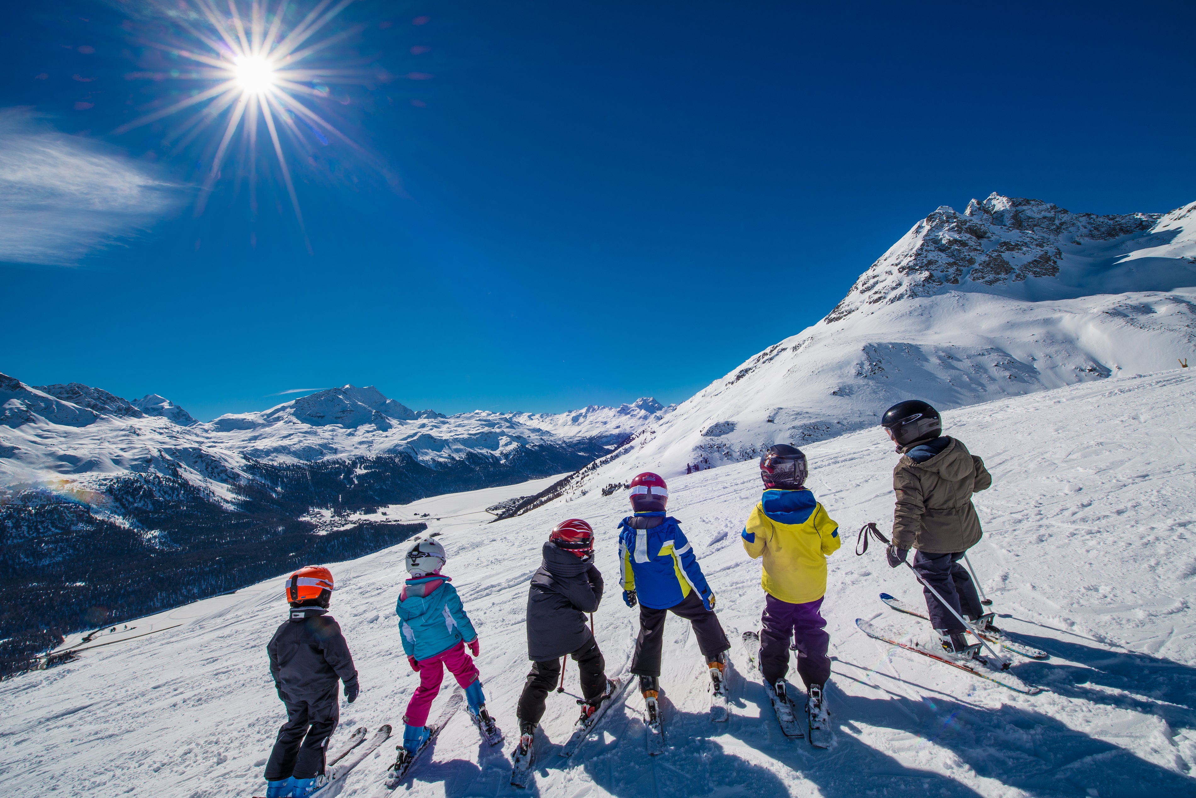
Managing Groups
Tracking Groups in the Outdoors with GPS
When managing participants in the outdoors you often work as a team, whether that be DofE organisers tracking school age children on Duke of Edinburgh Award Expeditions or Ski Instructors tracking clients in a ski school. There is the need to share the locations & status of your Meili GPS Trackers with other people: we have built a comprehensive set of features to allow you to safely manage who sees what,and for how long. We call it the 'Sharing Centre' and with it you can create a shareable link from which the users you authorise can download the Meili Earth app (at no cost).
The Sharing Centre provides third parties with access to the Meili GPS trackers you have chosen to share for a fixed length of time that you define: meaning you can work as a team with DofE volunteers, ski instructors or other family members, or friends, and then revoke access as required.
Crucially we have built the sharing centre with the safeguarding of children in mind so each sharing link automatically expires at a time you choose, eliminating the risk that location sharing is retained after it is needed.

SOS!
Meili GPS Tracker SOS Feature
Each Meili GPS Tracker has an SOS button which when pressed for more than 10 seconds sends an alert to your team via the Meili Earth app.
When deployed the Meili GPS Tracker initially initially vibrates once to let the user know it has sent the alert, then, once the alert is acknowledged by a team member via the Meili Earth app, it buzzes three times to let the user know that the alert has been received, giving them the reassurance that help is on the way.
In the Meili Earth App, users see the alert as a notification whether the app is open or not, and if the alert is not acknowledged users are sent an SMS as a backup.
The SOS button provides the individual (or group) carrying the Meili GPS Tracker with the means of getting your attention and is a great way for the team who are monitoring the group (or individual) to see when they are needed.

1:25,000 Outdoor Maps
Meili GPS Outdoor Maps with Global Coverage
The Meili Earth App features 1:25000 outdoor maps to give you the very best mapping options, and detail, available, with global coverage.
1:25,000 maps are so much better than standard online maps (which are designed for road transport and urban environments) but do not provide the level of detail that is required for the outdoors.
Meili Earth Maps show ski runs, chair lifts, mountain bike tracks, hiking tracks and even the location of nearby refuges in mountainous areas.
Meili's 1:25,000 maps provide global coverage.

How to get started with Meili GPS
How to Purchase Meili GPS
It's easy to get started. Simply click BUY in the top menu and choose the number of Meili GPS Trackers you want to purchase and checkout.
When you finish checkout you will be taken to the Global Airtime Plan page where you can choose to pay monthly or annually. You will require a Global Airtime Plan for each of your trackers - these are termed "slots".
This is a separate checkout process for the Global Airtime Plan.
Remember you can cancel or pause your Global Airtime Plan at any time and only pay for the payment period you are currently in.
It's simple to order more Meilis and increase your Airtime Plan accordingly via the 'Portal' link in the main menu.
If you are an organisation requiring an invoice, or wishing to pay via direct debit, these options are available to you via the check out process.